Google Maps gets new safety features for navigating during a pandemic
You’ve probably heard enough about how we’re living in “unprecedented” and “challenging” times, but it’s true. The COVID-19 pandemic has changed nearly every aspect of our daily lives, especially when it comes to leaving our homes. Navigating the outside world can be extra complicated these days and Google Maps is adding some new features to help.
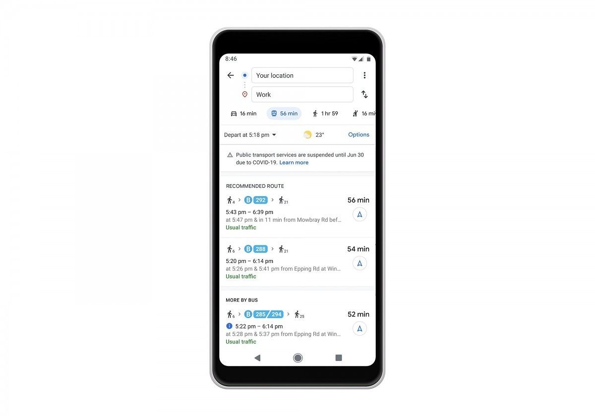
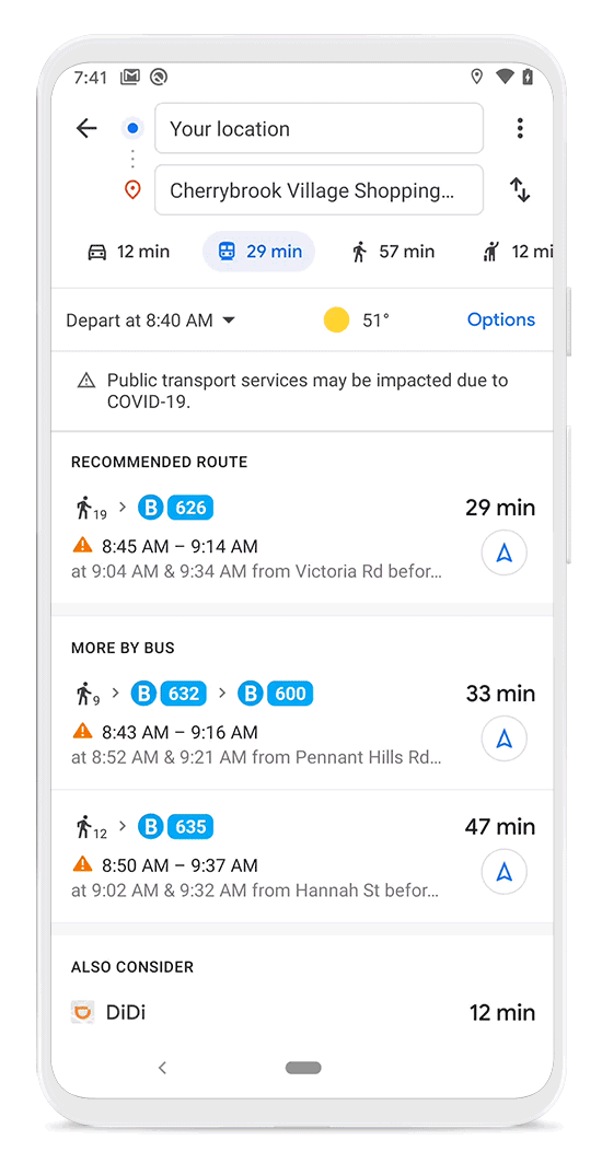
Public transit is one area of navigation that has been impacted the most. Google Maps will not show relevant alerts from local transit agencies so you can prepare accordingly. For example, you can see if government mandates have suspended services or if you’re required to wear a mask. These public transit alerts are rolling out in Argentina, Australia, Belgium, Brazil, Colombia, France, India, Mexico, Netherlands, Spain, Thailand, United Kingdom, and the U.S.

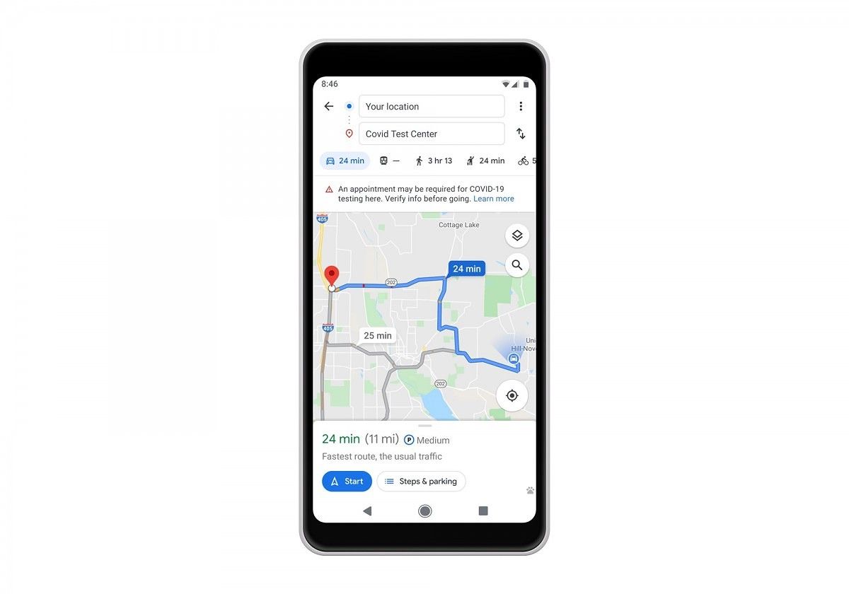
For those people who primarily navigate in cars, there will be alerts in Google Maps for COVID-19 checkpoints and restrictions along your route. This can come into play when crossing borders or driving to medical facilities. These alerts will ask you to double check restrictions so you can avoid being turned away and wasting time. Alerts for medical facilities will be available this week in Indonesia, Israel, the Philippines, South Korea, and the U.S., and testing center alerts will be available in the U.S.
Google is gathering the information for these alerts from local, state, and federal government websites. The company is also working with other agencies around the worth to gather more helpful information.
 |
 |
|---|
Next up is crowd predictions, which is something Google Maps introduced last summer. These predictions help people get an idea of how crowded a bus or train may be, which is an important consideration to make nowadays. Google is making it easier for people to contribute “crowdedness” information, which makes the data more accurate for everyone. People can now see live data for how busy a train or bus may be, similar to how Maps does it for restaurants. Google will only surface this insight when they have enough data to meet privacy thresholds.
The world is changing and it’s good to see Google Maps is adapting to it.
Maps - Navigate & Explore (Free, Google Play) →
Source: Google
The post Google Maps gets new safety features for navigating during a pandemic appeared first on xda-developers.
from xda-developers https://ift.tt/2MBSfPE
via IFTTT
No comments: